
 |
LIFETIME of WALKS by DEREK HARWOODDerek Harwood's Walking Records If you have any queries about the pictures or discriptions e-mail me at: derek@harwoodonline.com | ||||
 | |||||
| Peak District North/South Traverse Edale to Hargatewall Sunday 14th November 2004 ...............Walk No. 607 |
 | ||||
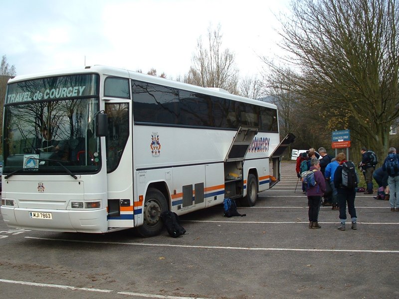
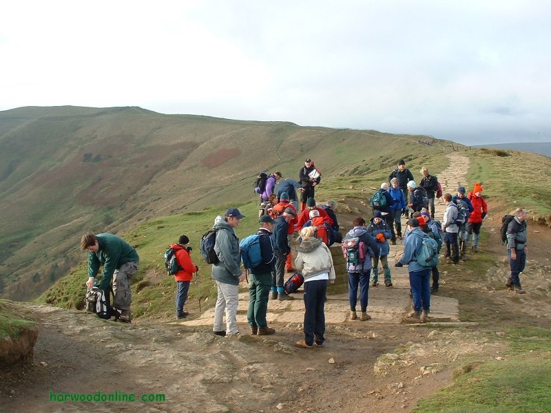
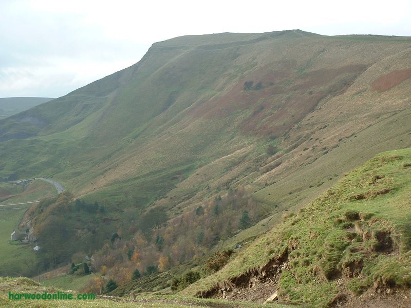
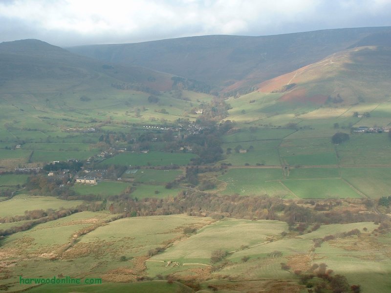
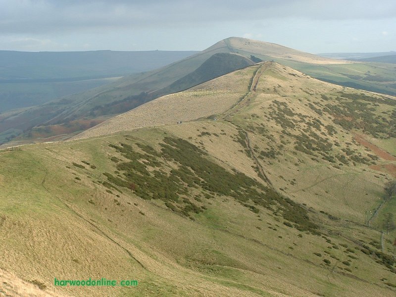
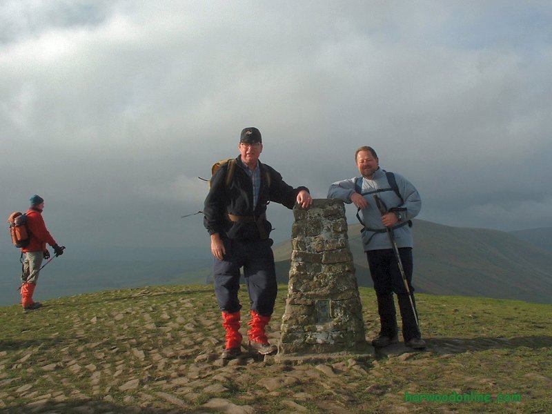
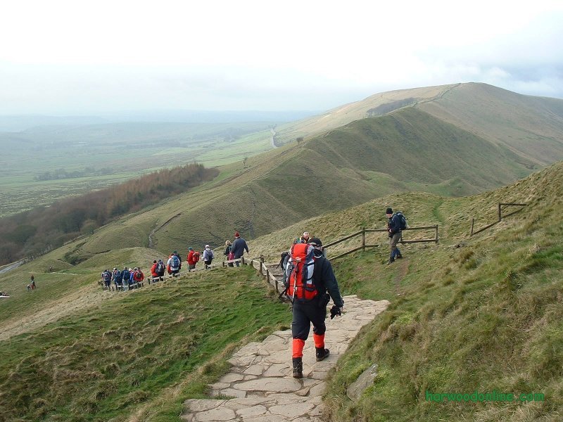
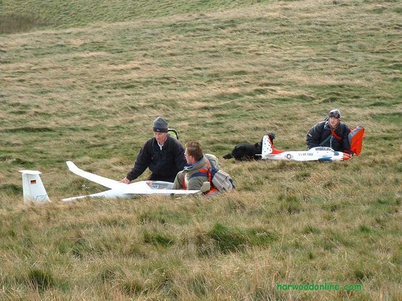
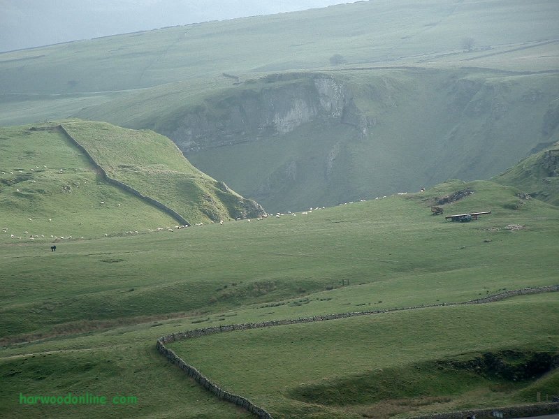
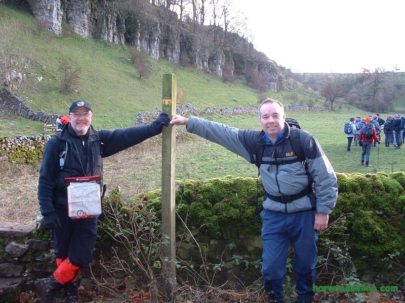
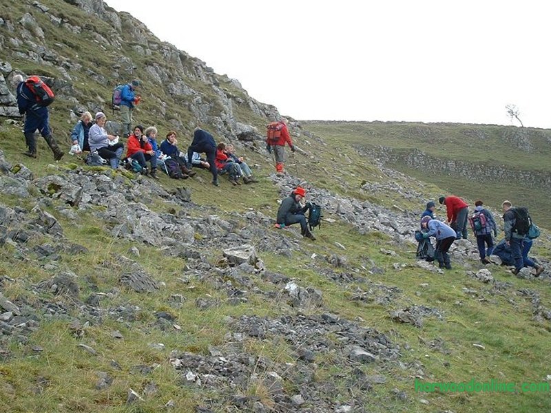
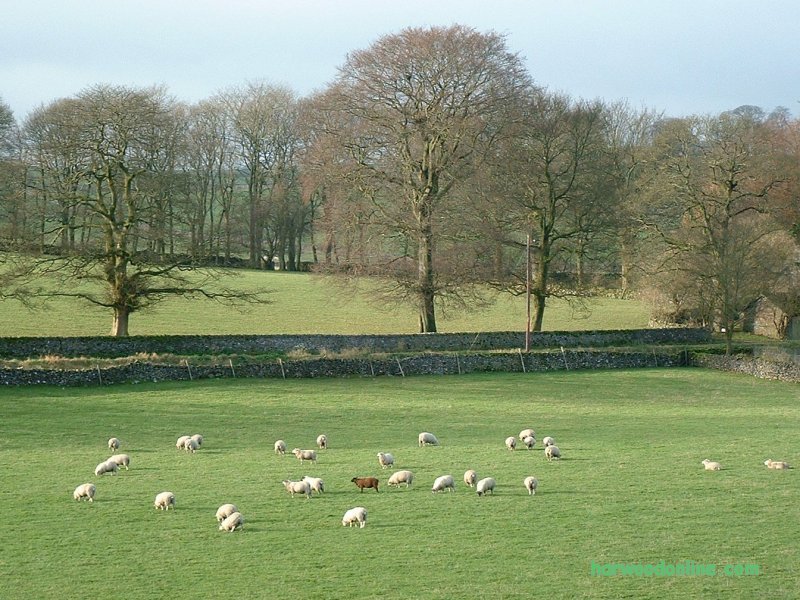
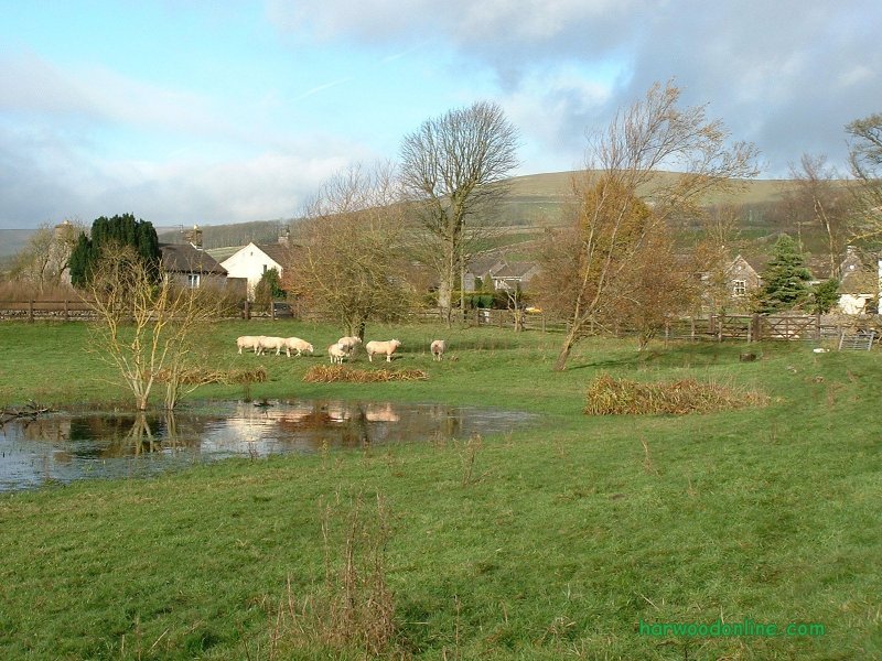
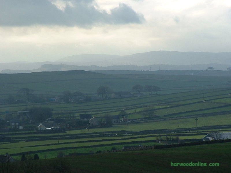
Midland Hillwalkers  No. 67                  Total 817 miles
'B'  Walk led by Ken Moulton

Time Taken:  5.25 hrs   Distance:   Enjoyment:    Weather:   Cloudy & Dull
 10:20 am - 3:35 pm        9 miles          80%               Very Windy on Tops

Temp:     Cloud:     Rain:    Visibility:    Ground Conditions:     Wild Life:
  9oC          90%        0%          Poor            Extremely Bad      Hares, Sheep

Total AA:    Total MH:   Total LD:    Total AW:     Other:    Total Distance:
 780.5 mls     817 mls    1700.5 mls     121 mls       898 mls      4433.5 miles

Companions: (Derek) Ken, Lynn and the contents of Trevor's coach.

Points of Interest:
Edale                  Vale of Edale              River Noe              Hollins Cross
Mam Tor                Winnates               Windy Knoll              Eldon Hill
Ox Low                  Old Dam                Peak Forest              Dam Dale
Hay Dale              Dale Head                Peter Dale                Wormhill
Hargatewall          Hargate Hall

Mam Tor :   1696 feet (517 metres)
General: Great care taken by Trevor to weave the coach through the narrow lanes to the car park at Edale. I joined the 'B' party led by Ken with Jack as the 'backstop'. From the car park gradual ascent up the slopes of Mam Tor, becoming steeper as we approached Hollins Cross. Weather kind as we strolled along the pavement on the ridge to the summit of Mam Tor. Excellent views all around, including Kinder Scout, Lord's Seat, Lose Hill, Castleton, Winnats and much more. It was very windy on the summit as we rounded the corner at the top of the ridge. Steps and handrail down from summit to car park near Windy Knoll. Watched the model aircraft enthusiasts displaying their flying skills on the slopes of Mam Tor. Pleasant stroll across moor and eventually fields to Old Dam Village. Many solid stiles in the stone walls where the steps have been built permanantly into the walls. Good balance required on some slippery stones. Walked past the idyllic setting of the village pond and Dam Hall to Peak Forest. Crossed over the A623 road with care to more green pastures surrounded by stone walls before we reached Dam Dale and lunch on the steep rocky slopes of the deep ravine. During lunch we watched several hares running across the opposite slopes back to their burrows. After lunch we continued along the bottom of the dales to Hay Dale and Peter Dale. The dales became muddier as we walked, or slithered, deeper into the Dales. Peter Dale was extremely muddy where the local cattle had churned the mud into a soup. I completed two pirouettes before we reached the road at the entrance to Monk's Dale. At this point we climbed out of the dale and over the fields to Wormhill where we were pleasantly surprised to find the Brindley Memorial. The running water feature of the memorial became a useful aid for cleaning our boots, handfuls of mud from the dale bottoms. From Wormhill it was a gently & steady climb up the lane to Trevor and the coach parked on the corner by Hargate Hall at Hargatewell Village. We all cleaned ourselves and enjoyed a welcome pint nearby in The Waterloo pub on the A6 close to Taddington. Thanks again to Jack & his leaders for another excellent day on the hills. www.streetmap.co.uk start Edale 412420/385305, finish Hargatewall 412075/375050, via Mam Tor 412745/383590 Hazards: Excellent views and constantly changing scenery. Can be very muddy in dale bottoms after recent heavy rain. Very steep descent and ascent into and out of Dales, but a very pleasant walk along the bottoms in dry weather with plenty of varied wildlife. | |||||
 | |||||
 | |||||
 | |||||
|
|||||
 | |||||
 | |||||
 | |||||
 | |||||
 | |||||
 | |||||
 |
 |
 |
 |
 | |
| Previous Walk : Next Walk : More Photos : 'Midland Hillwalking' Photos : 'Lake District' Photos | |||||
| News : Formula 1 : Walking : Table Tennis : Bellringing : My Friends : My Guestbook : CV : Links | |||||
Derek Harwood: Copyright 2004 Devised: November 2004 | |||||