
 |
LIFETIME of WALKS by DEREK HARWOODDerek Harwood's Walking Records If you have any queries about the pictures or discriptions e-mail me at: derek@harwoodonline.com | ||||
 | |||||
| LAKE DISTRICT WALK RED SCREES Saturday 3rd July 2004 ...............Walk No. 589 |
 | ||||
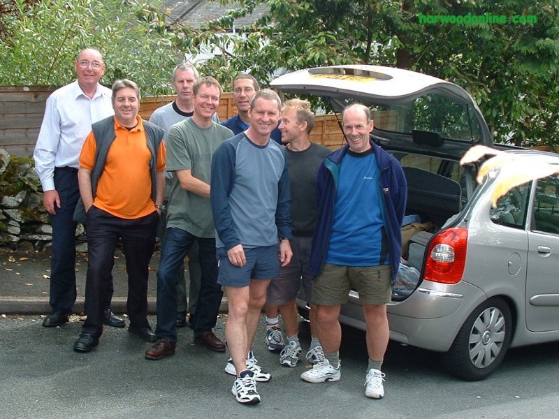
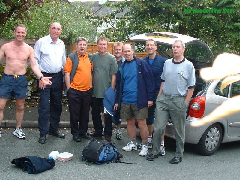
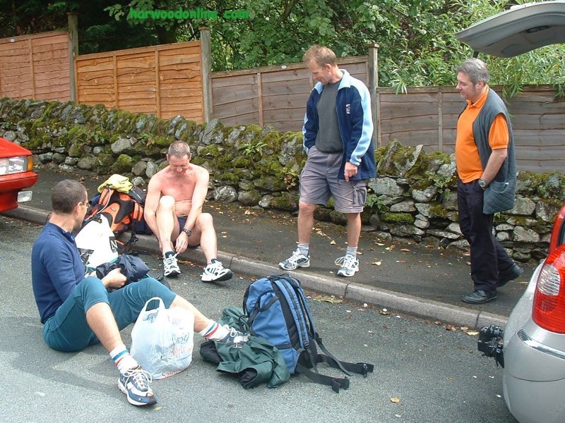
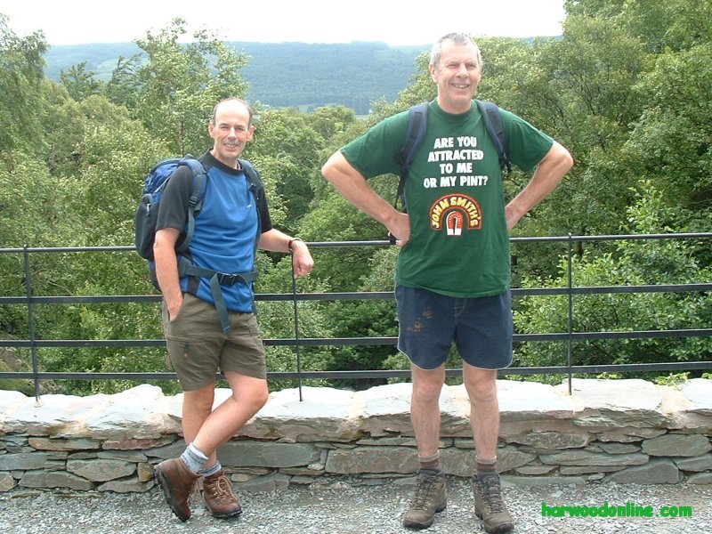
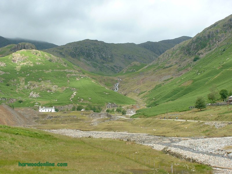
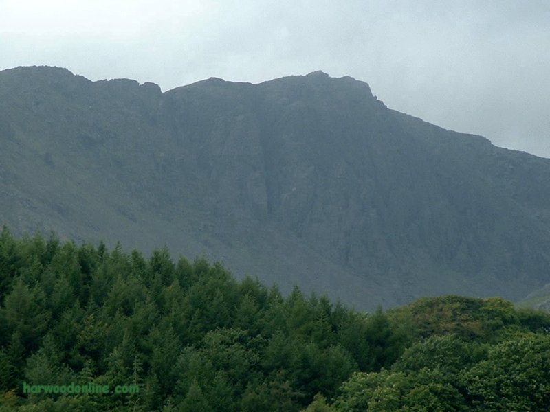
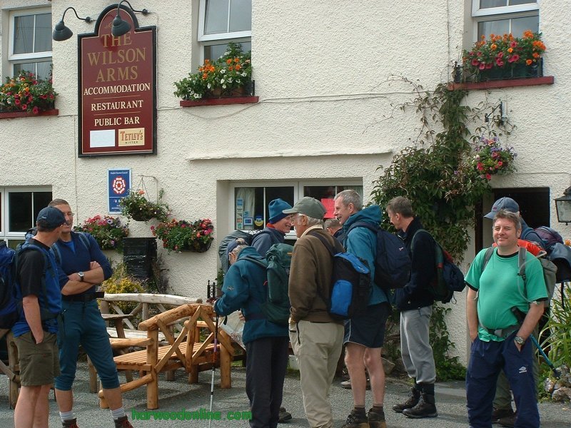
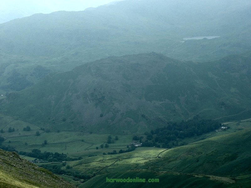
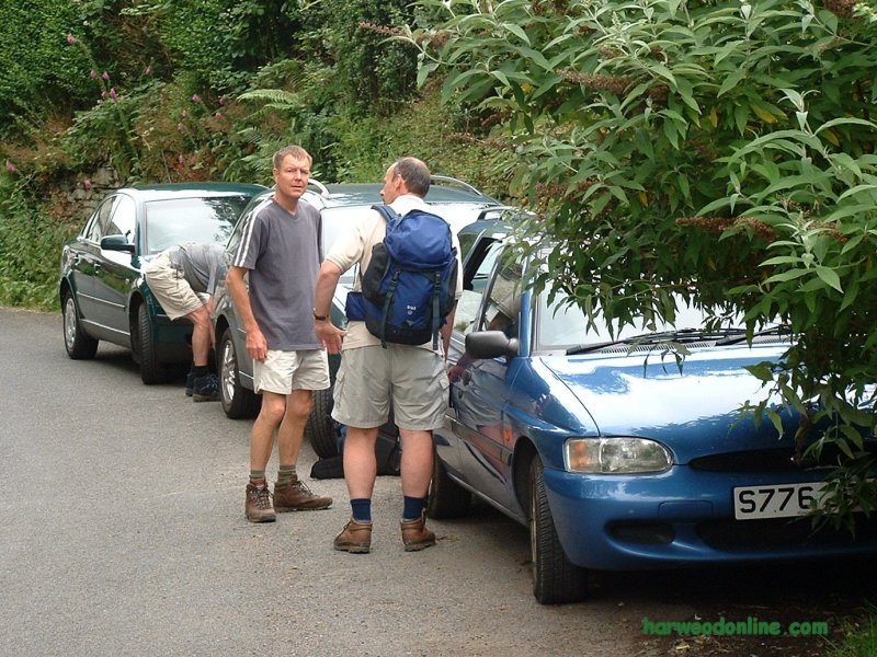
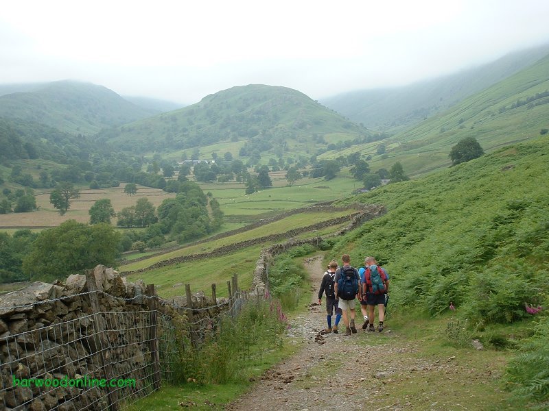
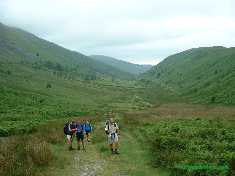
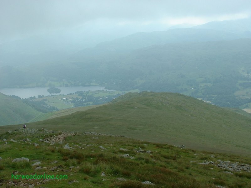
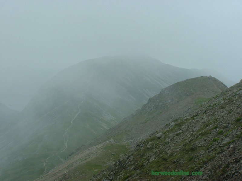
Lake District Walk  No. 40                 Total 140.5 miles
BT Walking Group No. 5 --- Walk led by Martin

Time Taken:  5.00 hrs   Distance:   Enjoyment:    Weather:   Cloudy & Wet
 10:30 am - 3:30 pm        9.5 miles          80%              Heavy Showers

Temp:     Cloud:     Rain:    Visibility:    Ground Conditions:     Wild Life:
  14oC        95%       25%        Good            Wet Underfoot        Birds, Sheep

Total AA:    Total MH:   Total LD:    Total AW:     Other:    Total Distance:
  796 mls       808 mls    1700.5 mls    140.5 mls      898 mls      4343 miles

Companions: (Derek) Colin, Bob, Will, Martin, Charley, Jim & Kevin

Points of Interest:
Ambleside              Nook End Farm           Low Sweden Bridge           Low Pike
High Sweden Coppice    High Sweden Bridge     Scandale Beck      White Howe
Scandale Bottom           Scandale Fell           Scandale Pass         Red Screes
Kilnshaw Chimney           Raven Crag            Snarker Moss           Snarker Pike
Flesh Crags                Kirkstone Road           Bridge House            Ambleside
Ambleside Backpackers

Red Screes :   2541 feet (776 metres)
General: Lakeland walk with BT Walking Group. Two nights staying at Ambleside Backpackers, www.englishlakesbackpackers.co.uk After a delayed start due to heavy rain, eight of us walked from the Backpackers through Ambleside to Nook Lane and past the College/Library to Nook End Farm. We continued through Low Sweden Coppice, over Low Sweden Bridge and onto the ridge path towards Low Pike. The rain eased as we climbed the ridge, so the views over Ambleside and Lake Windermere slowly unfolded. After some debate with Martin we found the track from the ridge down to High Sweden Bridge. The bridge is very sturdy and has stood the passage of time very well. However, care is required while passing over the bridge because there are no walls or fences at the side of the bridge to stop the user of the bridge from falling into the Scandale Beck. Because the weather had improved we decided not to return to Ambleside alongside the beck, but to walk in the opposite direction up to Scandale Bottom. As we continued the weather turned showery but with the occational bright spell. This improved the visibility immensely, opening up the fells all around Scandale Fell. We followed the path alongside the beck to the head of the valley where we all again decided to continue up to Scandale Pass. Before we could reach the pass we had to cross the beck. This looked difficult but a huge leap saw us all safely across to the other side and on our way towards the pass. I thought we were all across safely but Bob was limping slightly because he had aggrevated be groin. The day was slowly changing from a low level walk to a high level walk. When we reached the top of the pass we studied the map with Martin and all agreed to continue to the summit of Red Screes. We followed a long and old stone wall steeply up to the top. This was made more difficult by the wind and heavy showers which were not in our faces. As we reached the trig point we were surprised by a small tarn so close to the summit. Martin took a photo of the group on the top using his state of the art telephone. During this time the rain stopped and a fantastic view opened up across to Helvellyn, Ullswater and High Street. Kirkstone Pass was right below our feet. The cars struggling up the pass looked like dinky cars. That five minutes of scenery made the day. As we turned back down the ridge towards Snarker Moss we could see the rain heading our way from the Scarfell Pike direction. Sure enough the squally shower was in our face. We were paying the Lakeland price for the wonderful views. The descent down the ridge was steady with good views again across to Lake Windermere. We reached the Kirkstone Road and followed our noses into Ambleside and a welcome change from the soggy walking gear before our journey south down the M6 motorway. Thanks to Martin for changing a low level walk into a very good high level walk with some excellent views across the lakes. www.streepmap.co.uk start/finish Ambleside 337750/503930, via Red Screes 339630/508750 Hazards: Take extra care when walking in rain. Beside the slippery rocks the visibility in hugely impaired, making map reading much more difficult. Do not attempt a lengthy walk on high ground in bad weather unless the area is well known. | |||||
 | |||||
 | |||||
 | |||||
|
|||||
 | |||||
 | |||||
 | |||||
 | |||||
 | |||||
 | |||||
 |
 |
 |
 |
 | |
| News : Formula 1 : Walking : Table Tennis : Bellringing : My Friends : My Guestbook : CV : Links | |||||
Derek Harwood: Copyright 2004 Devised: July 2004 | |||||