
 |
LIFETIME of WALKS by DEREK HARWOODDerek Harwood's Walking Records If you have any queries about the pictures or discriptions e-mail me at: derek@harwoodonline.com | ||||
 | |||||
| PEAK DISTRICT NORTH/SOUTH TRAVERSE Ladybower Reservoir to Edale Sunday 21st March 2004 ...............Walk No. 576 |
 | ||||
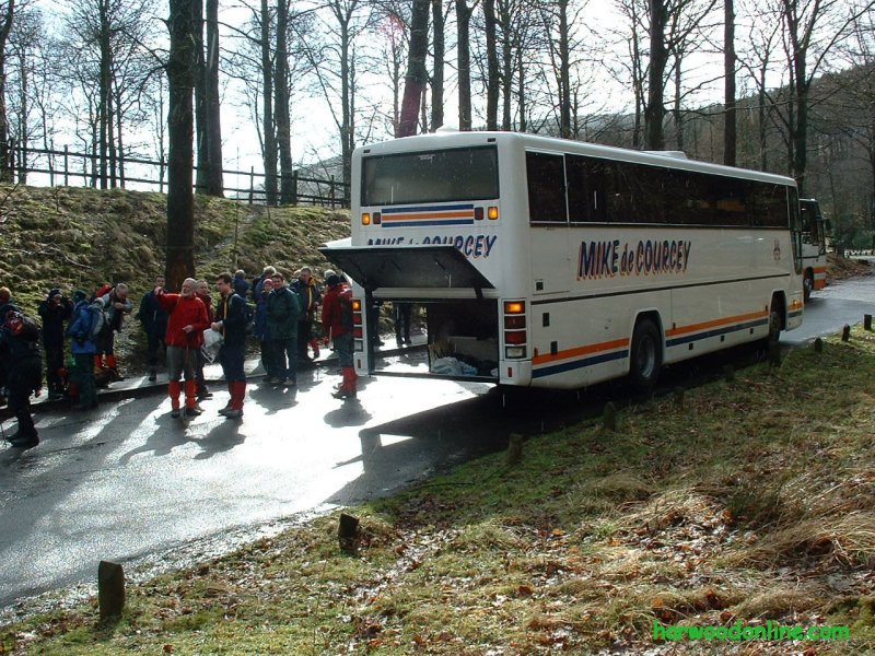
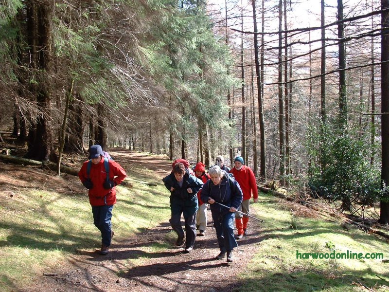
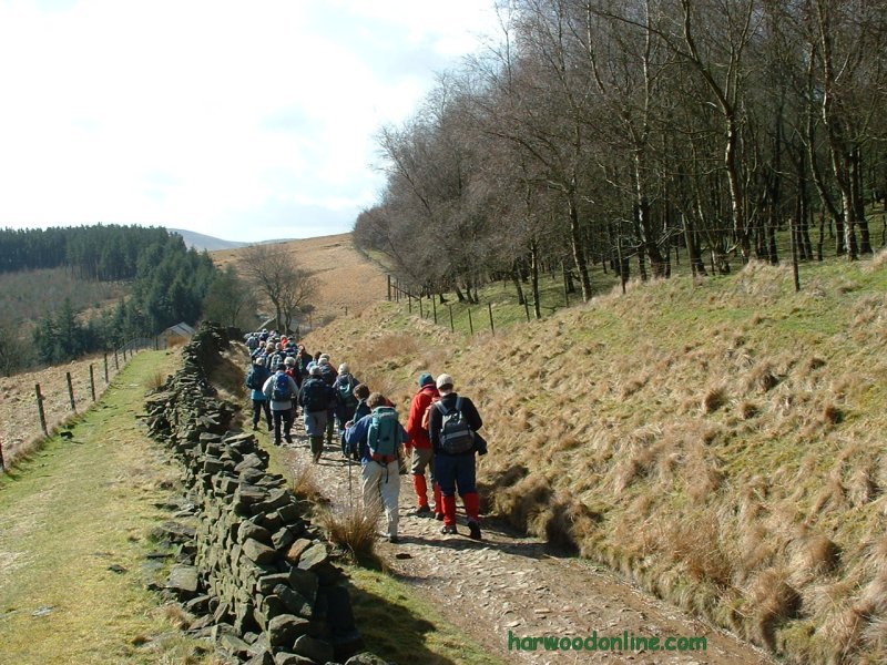
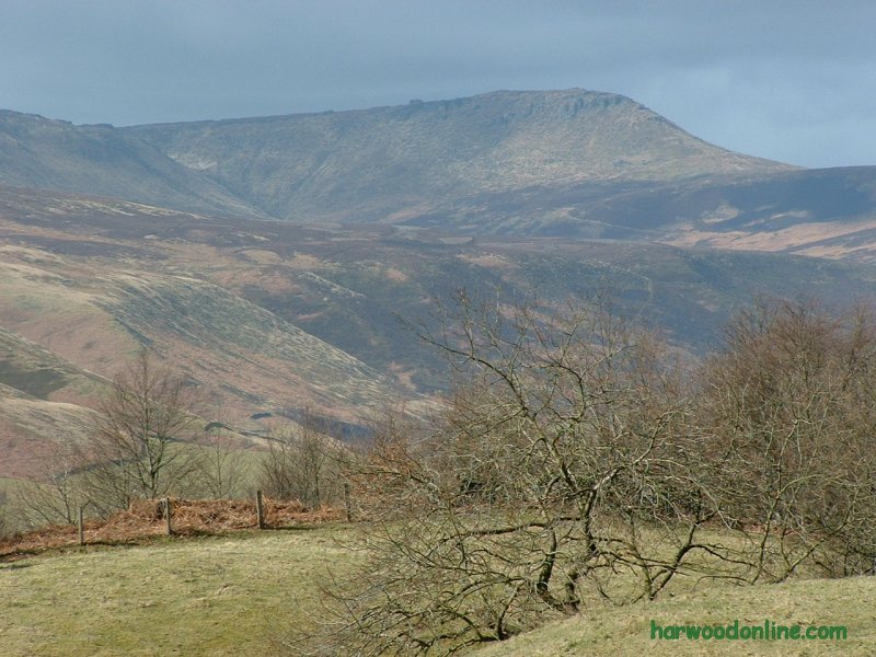
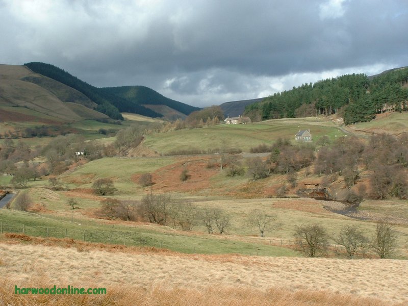
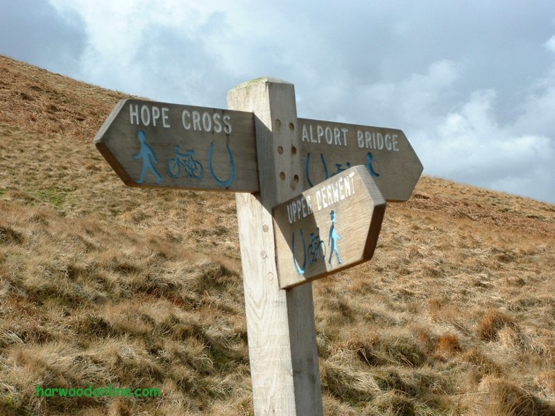
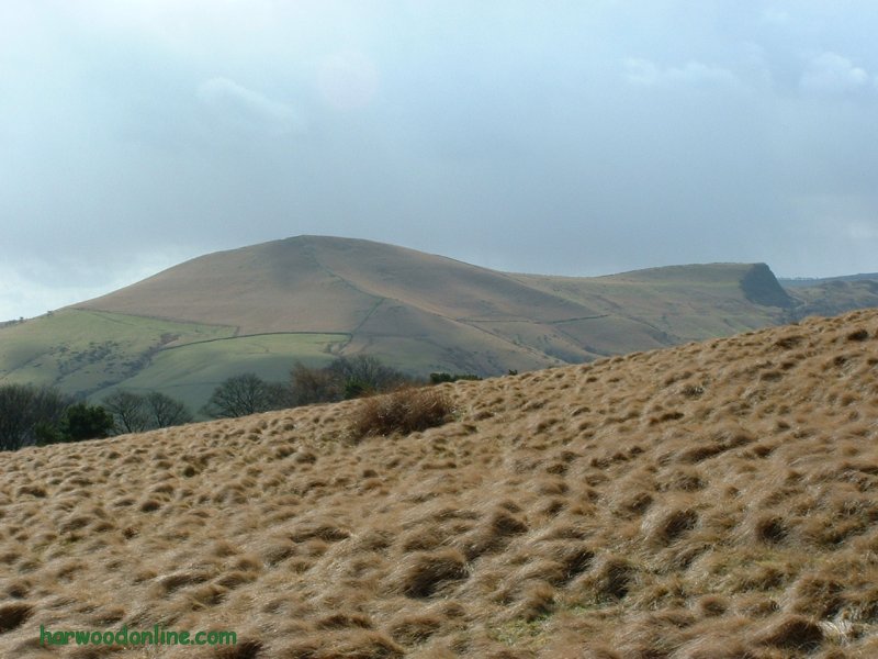
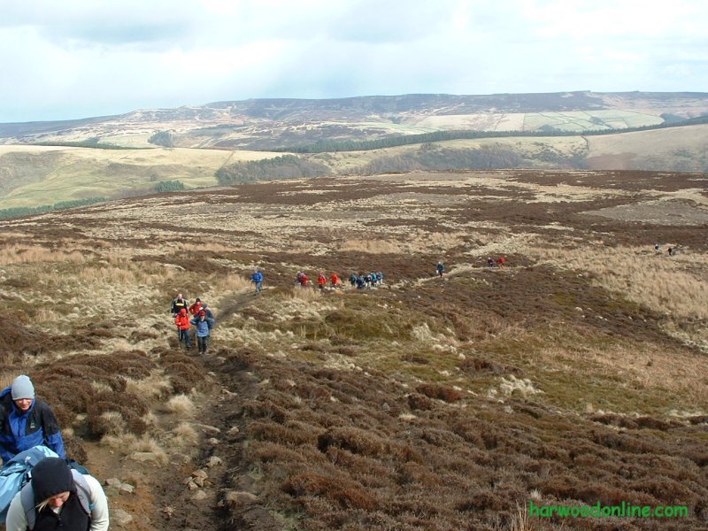
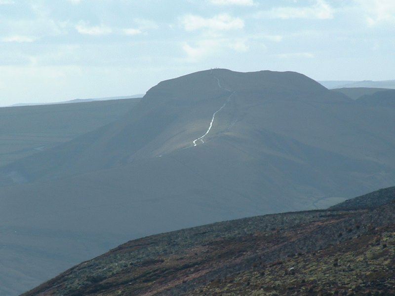
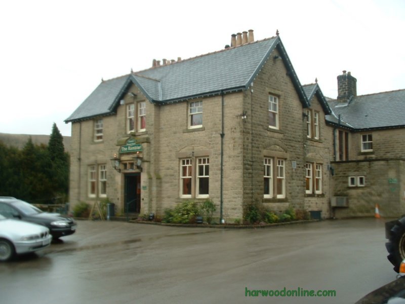
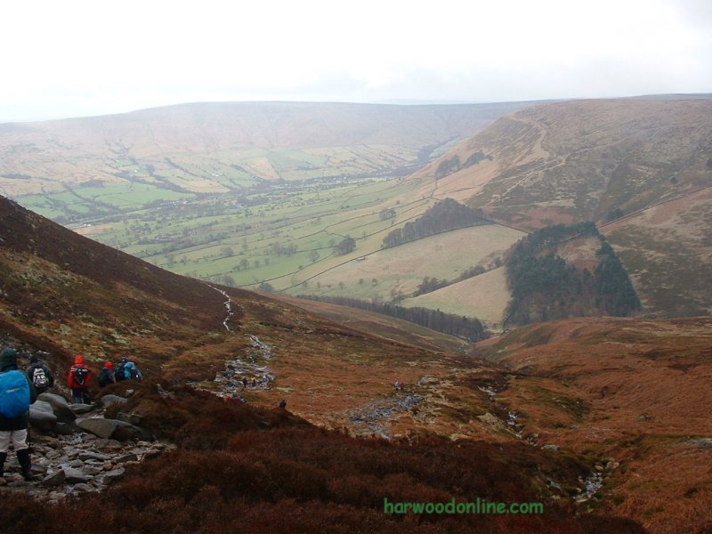
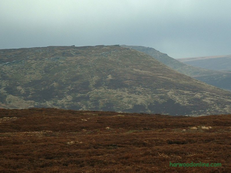
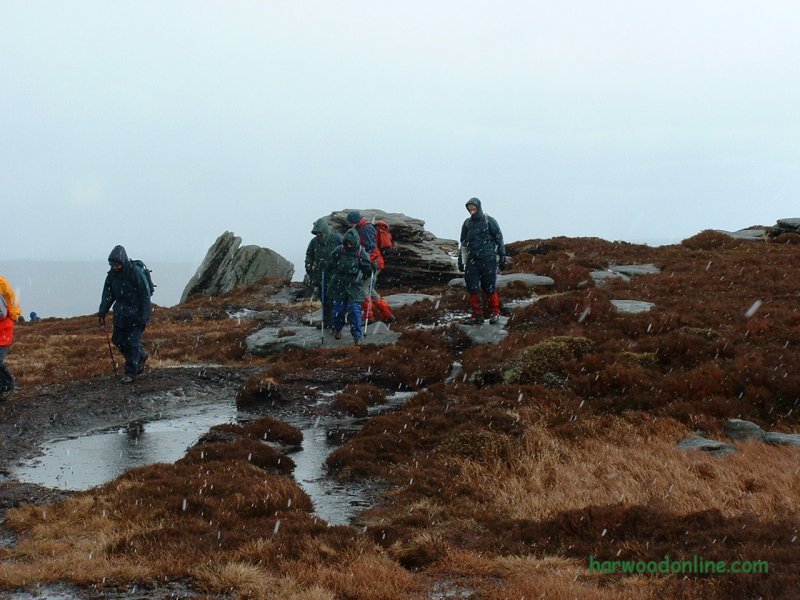
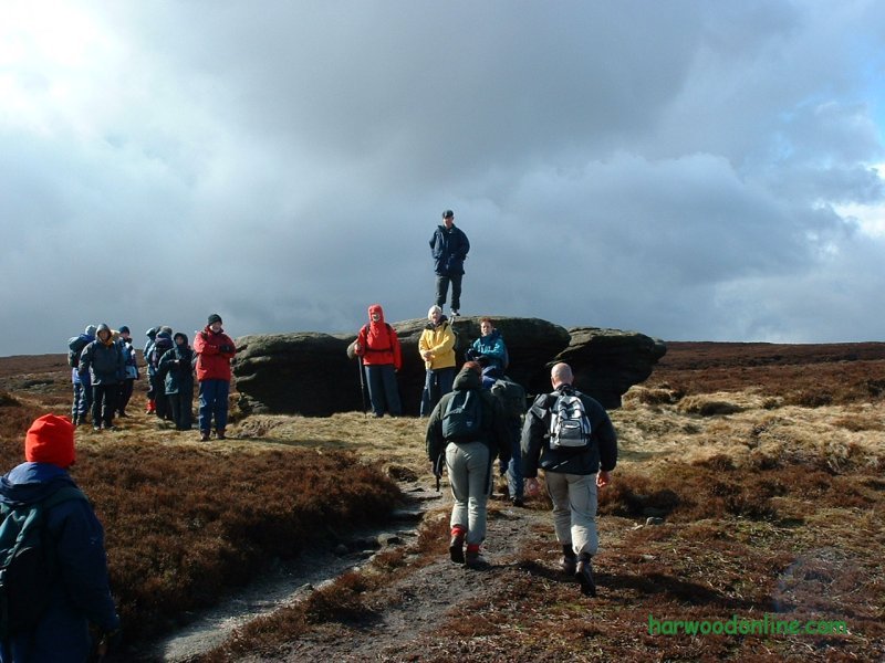
Midland Hillwalkers  No. 64                  Total 786 miles
'B'  Walk led by Bill Murrow

Time Taken:  5.25 hrs   Distance:   Enjoyment:    Weather:   Sunny Periods &
 10:30 am - 3:45 pm       7.5 miles       75%     Showers turning Cold, Wet with Hail

Temp:     Cloud:     Rain:    Visibility:    Ground Conditions:     Wild Life:
   8oC         65%       50%        Muddy                  Wet                Birds, Sheep

Total AA:    Total MH:   Total LD:    Total AW:     Other:    Total Distance:
  759 mls      786 mls    1700.5 mls     121 mls       898 mls     4264.5 miles

Companions: (Derek) Ken, Lynn and the contents of Trevor's coach.

Points of Interest:
Ladybower Reservoir           Lockerbrook Coppice           Lockerbrook Heights
Woodcock Coppice         Bellhagg Tor         Woodlands Valley        Rowlee Bridge
Blackley Hey       Blackley Clough        Crookstone Knoll       Crookstone Out Moor
Madwoman's Stones    Kinder Scout East OS Column    Nether Tor    Ringing Roger
Golden Clough          Grindsbrook         Grindsbrook Booth        Edale & Station

Kinder Scout :   1936 feet (590 metres)
General: Third section of Peak District North/South Traverse. 25 miles to 32.5 miles. Started from Ladybower Reservoir at picnic area by service road and just before Derwent Reservoir dam. Steep climb from road through Lockerbook Coppice to Lockerbrook Farm. Continued from Lockerbrook Heights on a good track circling below Bellhag Tor and Pasture Tor. Good views up Woodlands Valley to Ashop and Blackden Moors. Descended into Valley passing Rowlee Farm to Snake Pass Road A57. Crossed road with care and continued over Rowlee Bridge to good signpost at footpath 'T' junction on Blackley Hey. Steady climb past Blackley Clough to another junction of footpaths below Crookstone Hill. Passed numerous cyclists and motorcyclists descending with speed into Woodlands Valley. This explained the deep rutted and well eroded path out of the valley. Weather changed from sunshine and showers to constant rain & hail as we slowly ascended to Crookstone Knoll and a well earned rest for lunch on the rocks. We would have preferred whisky on the rocks but that came later in The Rambler at Edale. Tried to shelter behind the Knoll rocks without much success. From lunch we continued over Crookstone Out Moor past Madwoman's Stones to high point and OS Column, the east summit of Kinder Scout. We were constantly dodging the peat hags as we studied the best route towards Nether Tor. The ground was very wet and the hail at this point horizontal into our faces. Suddenly we realised that Janet had stepped into a deep peat bog and had hurt herself. There was plenty of help to hand but the pain was obviously too much for Janet to continue. We suspected a broken ankle. It was agreed that five group members would stay with Janet until help arrived and the remainder would continue. As we crossed the top of Nether Tor it was decided to cut the walk short and descend to Edale down Golden Clough, due to lack of time and the unrepentant weather. We doubled back to the clough and walked into a constant stream of fell runners on their challenge around the top edge of Kinder Scout. As we descended under Ringing Roger the mountain rescue volunteers hastily passed us on their way to help Janet. We were amazed at the number people hurrying up the clough, then we realised that they were stationed at the car park in Edale due to the fell race. We arrived at Trevor's coach in Edale car park, changed and waited for news in The Rambler pub. The five club arrived back at the bus and explained that Janet was to be air lifted to Sheffield General Hospital at 5:15. On the journey home Bill received news from the hospital and informed the coach that Janet's injury was a very badly sprained ankle and Janet could go home. A lift had been arranged. Thanks Bill for another enjoyable 'Moderate B Walk' www.streepmap.co.uk start 417225/389330, finish 412385/385285, via 412905/387800 Hazards: Great care always required while walking on high ground, especially in bad weather. Lone walking is not recommended over this type of terrain. A mobile phone signal is not guaranteed. | |||||
 | |||||
 | |||||
 | |||||
|
|||||
 | |||||
 | |||||
 | |||||
 | |||||
 | |||||
 | |||||
 |
 |
 |
 |
 | |
| News : Formula 1 : Walking : Table Tennis : Bellringing : My Friends : My Guestbook : CV : Links | |||||
Derek Harwood: Copyright 2004 Devised: April 2004 | |||||