
 |
LIFETIME of WALKS by DEREK HARWOODDerek Harwood's Walking Records If you have any queries about the pictures or discriptions e-mail me at: derek@harwoodonline.com | ||||
 | |||||
| LAKE DISTRICT WALK TROUTBECK PARK Saturday 5th July 2003 ...............Walk No. 558 |
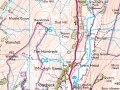 | ||||
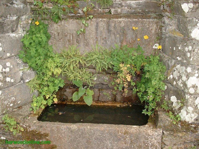
Lake District Walk No. 38 Total 121 miles Time Taken: 4.50 hrs Distance: Enjoyment: Weather: Cloudy 10:30 am - 3:00 pm 8.5 miles 80% Misty on tops Temp: Cloud: Rain: Visibility: Ground Conditions: Wild Life: 18oC 100% 3% Very Poor Boggy in places Sheep Total AA: Total MH: Total LD: Total AW: Other: Total Distance: 711 mls 730.5 mls 1691.5 mls 121 893.5 mls 4147.5 miles Companions: (Derek) Colin & BT Walking Group. Walk led by Martin Points of Interest: Troutbeck Village Trout Beck Limefitt Park Town Head High Streeet The Tongue Froswick Troutbeck Park Threshthwaite Mouth Park Fell Head Stoney Cove Pike Troutbeck Clapper Bridge Ing Bridge High Green General: Lakeland Walk with BT Walking Group. Two nights in bunk house with Colin & BT mates in small bunk room sleeping seven. Colin drove and parked on the minor road in Troutbeck Village. Walked down lane past Coach House to 'A592' and church. Walked through Limefitt Park camp site to track along hillside. Continued past farms, an old tractor and a very unusual pulley system on the hillside. When we reached 'The Tongue' hill we diverted onto 'High Street' Roman Road by jumping across the stream and climbing a rickety fence, although the original path soon merged with track via a small wooded bridge. Stopped at the head of the valley for dinner where the discussions included bulls. Continued walking around the top of 'The Tongue' into Park Fell Head with views of Threshthwaite Mouth just in the mist. Watched a group of walkers progressing up the valley from Troutbeck Park, we were hoping for clues for the best place to cross the beck and bank of ferns, but they stayed on the west bank for the whole route upto the mouth. Difficult walking on rocky and wet path through the Park to the farm. Troutbeck Clapper Bridge very big and impressive. Picturesque water rapids in wood just after clapper bridge and two small cupped hollows in the rock, suitable for mixing paints. How old were the hollows? Plenty of barking dogs locked in barns of Troutbeck Park Farm. Tarmac road from farm to Town Head via Ing Bridge. Family with small children and pushchair lept from road into gate entrance as two tractors sped past on Ing Bridge. Left the tarmac road and continued up a rocky path to A592 where Colin collected two huge bolders for his rock garden. His ruck sack was strained to limits with weight. Returned to Troutbeck Village past well to Jim and his sore foot waiting in lay-by near to phonebox. www.streetmap.co.uk Start/Finish 340765/502740, via 342380/508280 Hazards: Varied Lakeland walking along lanes and over rocky terrain. Wear good stout footwear. Martin's book of low level walks very useful when mist is on the tops. Trout Beck very inviting at times. Don't be tempted into a quick dip, water always very cold in Lakes. Keep your socks on at all times. | |||||
 | |||||
 | |||||
 | |||||
 | |||||
 | |||||
 | |||||
|
|||||
 | |||||
 | |||||
 | |||||
 | |||||
 | |||||
 |
 |
 |
 |
 | |
| Previous Walk : Next Walk : More Photos : 'LifetimeofWalks : 'Lake District' Photos | |||||
| News : Formula 1 : Walking : Table Tennis : Bellringing : My Friends : My Guestbook : CV : Links | |||||
Derek Harwood: Copyright 2009 Revised: November 2021 | |||||