
 |
LIFETIME of WALKS by DEREK HARWOODDerek Harwood's Walking Records If you have any queries about the pictures or descriptions e-mail me at: derek@harwoodonline.com | ||||||
 | |||||||
| Lands End to John o'Groats Fill-in Path
Invesness to Cromarty Bridge Black Isle Friday 18 May 2018 ..........................................Walk No. 1172 |
 | ||||||
Lands End to John o'Groats Fill-in No. 46  Total 390.5 miles


Time Taken:  6:00 hrs               Distance:                Enjoyment:               Weather: No
 09:15 am - 15:05 pm                15.0 miles                      90%                             Rain

Temp:      Cloud:        Rain:       Visibility:        Ground Conditions:               Nature:
 18oC         60%           0%          Excellent                     Good                              n/a

Total AA:            Total MH:       Total LD:         Total AW:          Other:         Total Distance:
 1126.5 mls        976.0 mls     3670.0 mls       174.5 mls      2002.0 mls      7949.0 miles

Companions:  (Derek)

Points of Interest and LINKS:
Land's End to John o' Groats		Drumnadrochit      		Cromarty Bridge Black Isle
Inverness    					Great Glen Way
Description:
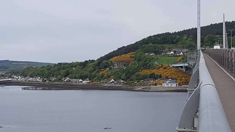
Breakfast at Wetherspoons as usual, then a short walk to the car in the multi-storey car park to collect and leave items required, or not required for walking. I walked from the car park (Rose Street) along Longman Road )A82) towards the A9. At the A9 I turned left towards Keswick Bridge and Wick. A good walking/cycling path alongside the A9 to Black Isle. I crossed the very busy road with great care for a quiet lane to Munlocky village. The quiet lane in practice was quite busy and with no footpath. I was hopping on and off the road verge like a rabbit. It was a steep climb up to Kessock Equine Vets, then a steady drop to almost sea level just before Munlocky. A local man in a car stopped for a chat, said there was a route being constructed to John o' Groats but not signposted yet. The internet said that it would be some time before the route was open, because stiles had to be constructed etc. I passed a wooden dog, outside a house, which was very large and life-like (hound). I passed Knockbain War Memorial at the junction of Knockbain Road and main road B9161. Again a busy road with no footpath. Extra care was needed at Littlemill Burn Bridge, up the hill into (Millbank Road) into Munlocky village, passing the impressive Knockbain Parish Church. I went into the village shop for some talcum powder but no luck. I had a long chat with shop assistants. I turned left through Station Brae village (U2582) to main road A832, crossed the road to continue on the lane towards Cromarty Firth, slowly gaining height on the straight road passing Knockbain Schoolhouse Cottage by Schoolhouse Wood. It was a steady climb further up the road to Old Post Office House, with surprise, surprise, a red telephone box outside. I spotted the odd John o' Groats Trail sign on a post, but not enough, unfortunately, to consider following. The trail was not marked on the OS map so the task of following the Trail was almost impossible. The high point was reached at Upper Knockbain Wood, then there was a beautiful sight of Cromarty Firth, with snow on the distant mountains and bright yellow gorse along the hedgerows. Care was required to choose the correct lane into Culbokie Village. Glascairn Road was used between woods (Culbokie Wood). There was a new housing development by lovely big houses as I walked into Culbokie Village. I spotted an old horse on a mound of barren soil with the odd clump of grass. He/she was grazing merrily, with a long mane and bushy tail down to the ground. I reached the main village road at the corner shop (post office) B91, but walked by to the Culbokie Inn. Turning left at the inn and down a steep lane I reached the A9 trunk road. There were road works on the Firth Bridge so traffic queues were lengthy in both directions. I picked my way through traffic cones on the bridge to an island at the end of the bridge, junction of A9 and A862. As I approached the island I could see a bus travelling on the A9 along the Firth coastal road. I crossed the road quickly to a lay-by and hailed the bus. The bus X25 stopped and cook me to Inverness bus station. I made enquiries about buses from Bonar Bridge to Alness, but couldn't get any sense because they only dealt with Stagecoach buses. It was a long and tiring walk, but rewarding. A step further to my goal.
Click Here for Previous Walk on the Fill-In Walk - Walk 1171 Click Here for Next Walk on the Fill-In Walk - Walk 1173 Click Here to Return to 'Lifetime of Walks' Homepage | |||||||
 | |||||||
 | |||||||
 | |||||||
 | |||||||
 | |||||||
|
|||||||
 | |||||||
 | |||||||
 | |||||||
 | |||||||
 | |||||||
 | |||||||
 | |||||||
 | |||||||
 | |||||||
 | |||||||
 |
 |
 |
 |
 | |||
 |
 |
 |
 |
 | |||
 |
 |
 |
 |
 | |||
| Previous Walk : Next Walk : More Photos : Favourite Walk : 'Lake District' Photos | |||||
| News : Formula 1 : Walking : Table Tennis : Bellringing : My Friends : My Guestbook : CV : Links | |||||
Derek Harwood: Copyright 2009 Revised: April 2023 | |||||